Opened 15 years ago
Last modified 15 years ago
#219 new support
Support: 17/Dec/08, Hassan Khavarian, Problems with azgcorr, queries about atmospheric correction
| Reported by: | benj | Owned by: | benj |
|---|---|---|---|
| Priority: | alpha 4 high | Milestone: | |
| Component: | Support | Keywords: | |
| Cc: | Other processors: |
Description
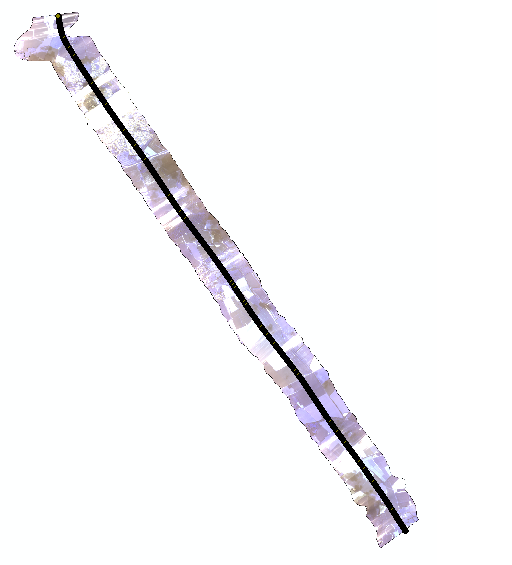
Initial contact via NEODC on 17/12/08, subsequently direct. User had various queries related to determining the pixel view vectors to allow atmospheric correction in ATCOR. The data he is interested in is GB06-10 (Chilbolton, 2006 day 168).
Issues unsolved thus far:
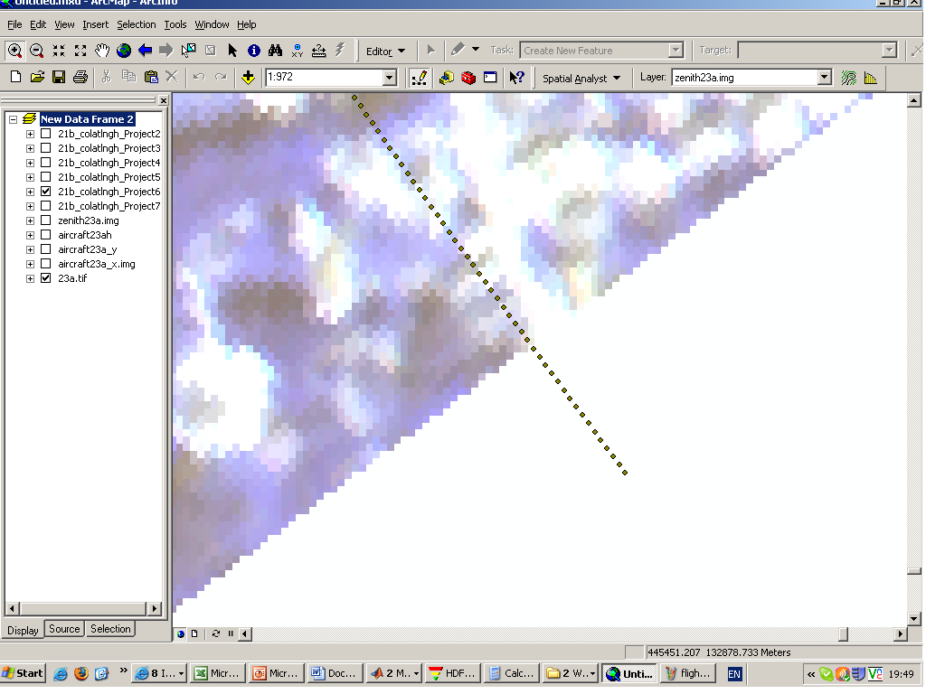
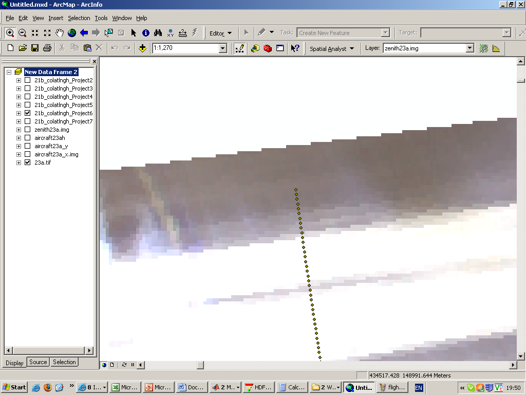
- Hassan reports the aircraft position seems to be off the position of corrected data by ~50m (possibly just that the sensor FOV is asymmetrical about the axis of flight, so it appears offset but actually isn't?)
- Haven't been able to supply a formula for determining zenith and azimuth of the aircraft from a given ground pixel (zenith and azimuth of the aircraft from a point on the ground aren't hard, the problem is working out which point on the ground we should be working it out for at a given moment).
Have also supplied a new test level 1 HDF for flight line 2 - he's been having problems with azgcorr hanging, suspect his level 1 HDF may be corrupt/otherwise incorrect, because it's substantially larger than the test one I got.
Attachments (3)
Change History (4)
Changed 15 years ago by benj
comment:1 Changed 15 years ago by benj
Turns out he meant an along-track offset rather than an across-track offset. I'm pretty sure the offset of aircraft position he refers to (see screenshots) is just caused by the boresight offset. He's just plotted the absolute aircraft position over the geocorrected flightline. For 2006 the CASI boresight angle is -0.7 degrees (ie the sensor is looking 0.7 degrees behind the aircraft), which at 2km altitude (assumed for calculation) will mean it's looking at a point on the ground 24.4m behind the sensor. If you count pixels at the top of the image, the offset is ~14 pixels (ie about 28m - those images are 2m resolution).
Flightline showing offset